Hi Folks,
Was uploading some panoramas I took in the outback to the diamantina-tour.com.au website yesterday and thought I would share them with you here as well.
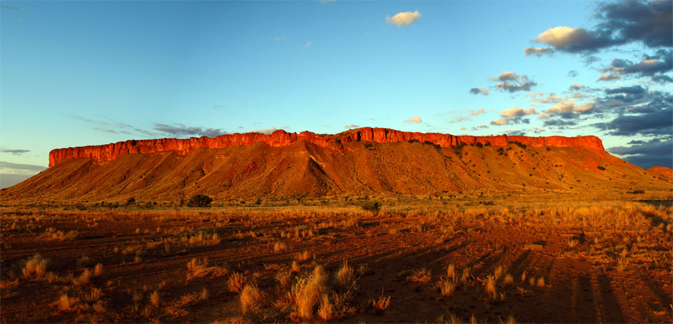
Breaden Hills Canning Stock Route
This image was taken at sunset at the Breaden Hills, which are around 100kms south of the northern end of the Canning Stock Route. The area is within the Southesk Tablelands, named by the explorer David Carnegie after his father the 7th Earl of Southesk. The hills hold significance to Aboriginal people, and contain stone tool sites, waterholes, a stone hunting hide and some petroglyphs. There was plenty of humidity in the air, and there was lightning about the tablelands. I was preparing dinner when the range lit up, so I grabbed the camera. My expedition to the Canning is here.
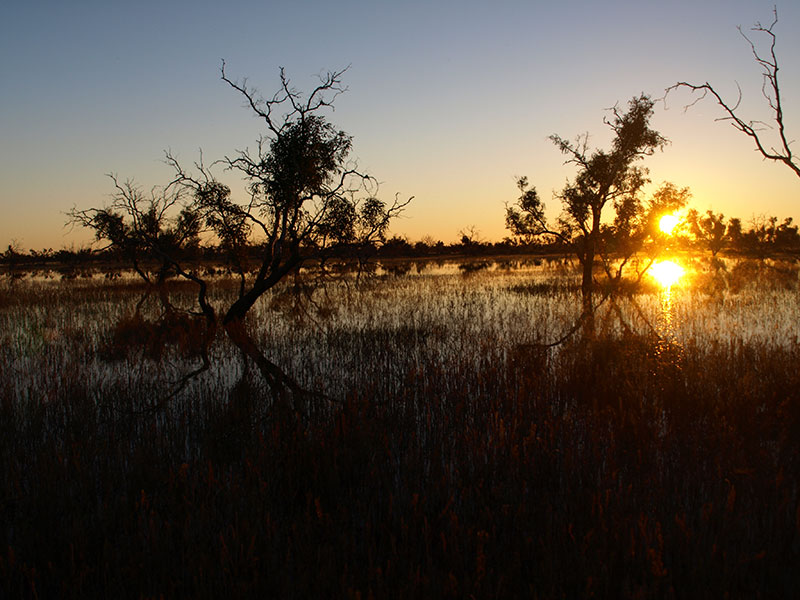
Sunset reflections on the flooded Cooper floodplain at Etadunna
In 2011 the Cooper had crossed the Birdsville Track, an event that only occurs every twenty odd years. We were heading down towards the mouth and camped in the horse paddock on Etadunna, right on the banks. The cacophony of birdsong was almost deafening as I wandered down to get a shot of the sunset. I returned to this very spot in May 2012 and it was a dusty clay pan, dry as a chip.
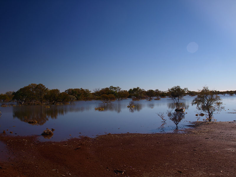
Flooded Lake Cohen in the Gibson Desert.
Lake Cohen is an ephemeral wetland in the middle of the Gibson Desert Nature Reserve. It is really a giant clay pan that regularly holds a sheet of water. It is an important wayside stop for migratory birds. There is no water for miles around, and it is about as remote a place in Australia as you can get, almost directly between Newman and Alice Springs.
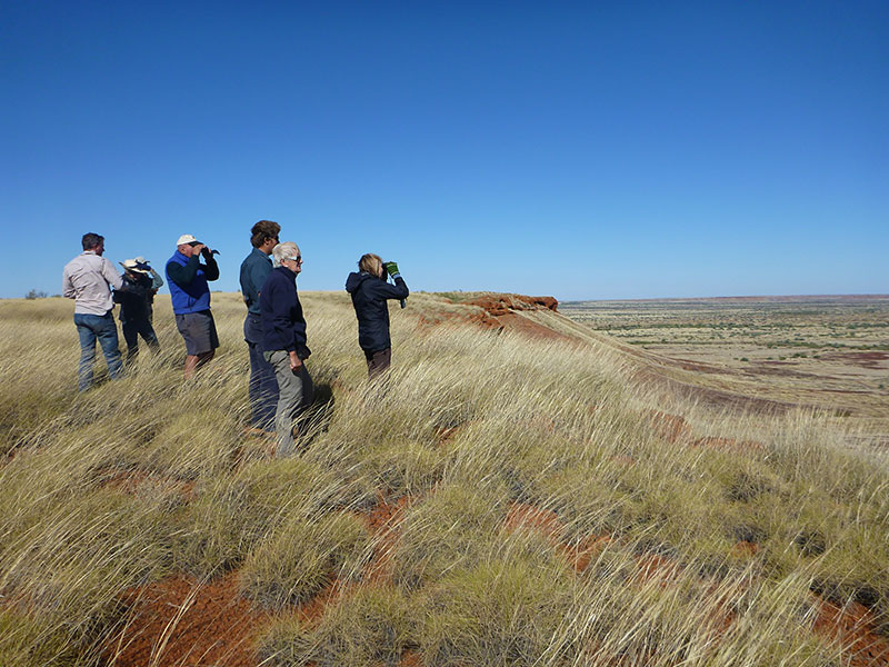
Looking out of Balgo Pound, a view to take your breath away
The Balgo Pound is one of the most spectacular breakaways in outback Australia, the flat spinifex plains of the Tanami Desert are broken by a spectacular laterite escarpment, the views take your breath away. We had been travelling for days up a track that doesn’t appear on any maps from Lake Mackay on the NT/WA border and suddenly arrived at the pound.
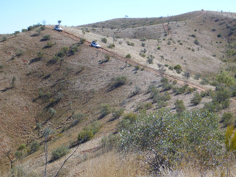
Vehicles descending on a steep track in the Sir Frederick James Range
The Frederick James Range is half way up the Sandy Blight Junction Road, a track put in by road builder and surveyor Len Beadell in 1963 as part of a network of roads for the Woomera Long Range Weapons testing program. Consisting of alluvial conglomerate, there is a steep 4X4 track to the summit. The view that awaits is astonishing. In this panorama you can see in the far distance the Peterman Range, with Lake Hopkins in the foreground. Though not in the photo, when we were there to the left we could see Mt Liebler in the Kintore Ranges, meaning the entire 380km Sandy Blight Junction track was visible from the top of this range.
Very nice pictures and a good commentary. Looks and sounds like you had a great trip.
Thanks Paul, It was a great season. I always feel I am privileged to be out there.
Everyone should try and go to the Breaden Hills, to say nothing of Lake Cohen. That lake, with water in it is really quite spectacular, particularly considering its position in the centre of the continent.
And they are vistas enjoyed all the more when shared with enthusiastic travellers and botanists like Alan Ford.
Its a pity the camera never does them justice!
I located your website from Google and I need to claim it was a wonderful locate.
Thanks!
Thank you Charolette, check out http://www.diamantina-tour.com.au for my expeditions to the Outback